-
 2001-2011 S.C. County Land Cover Changes
It was some "wormy" stuff, but I have made my first pass at comparing available land cover data between 2001 and 2011. My earlier posts were all about the 2001 data. The newer data uses some different classifications and causes me some concerns with the different treatment of some of the salt water and, for some reason, Floodplain Forests. Aside from that, I think it begins to give us a picture of what has changed in that 10-year period.
First, we might look at "Development" in the different counties. This made sense to me, but I was surprised to see it show that much in the mountains. Remember that we are looking at % changes and not absolute acreage changes between the counties.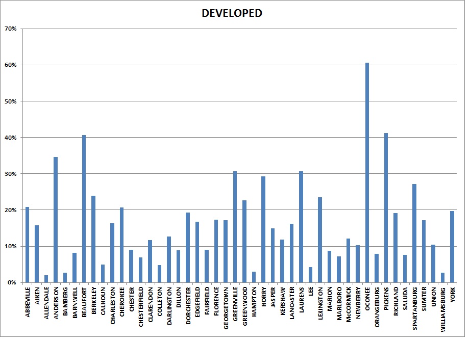
 Posting Permissions
- You may not post new threads
- You may not post replies
- You may not post attachments
- You may not edit your posts
-
Forum Rules


 Reply With Quote
Bookmarks